

I have navigated across the Te Araroa, the PCT, the CDT and the AT and hundreds of other multi-day backcountry trips. In 2026 does a handheld hiking GPS still earns its place now that every phone has offline maps. For thru hikers, backpackers and anyone heading off trail in bad weather, the answer is often yes, and this guide covers the best hiking GPS units I would actually carry in 2026.
Not everyone has mastered map and using a hiking compass. Those who have will appreciate a GPS unit that runs for days, survives rain and cold, and gives you an exact position without a phone signal.
My current top pick is the Garmin GPSMAP 67i, with the Garmin GPSMAP H1i Plus as the best premium model and the Garmin InReach Mini 3 Plus as the lightest way to get satellite messaging and tracking. The trade off you need to understand is reliability and battery life versus grams, because a full featured handheld costs you around 230 grams that a phone app does not. See the Quick Picks below, and for how I research and field test gear, see the Gear Review Policy.
Quick Picks: Best Handheld Hiking GPS
- Best overall hiking GPS: Garmin GPSMAP 67i: Multi band accuracy, 165 hours of battery with inReach tracking, and built in two way satellite messaging in one 230 gram unit. It does everything most backpackers need without stepping up to the flagship price.
- Best premium handheld GPS: Garmin GPSMAP H1i Plus: Garmin’s new flagship with a 3.5 inch touchscreen, buttons, and a built in camera and mic for sending photos and voice notes over satellite. Excellent hardware at a price that only makes sense if you use those features.
- Best ultralight satellite messenger: Garmin InReach Mini 3 Plus: At around 125 grams this is the lightest sensible way to carry SOS, two way messaging and tracking. Treat it as a messenger with basic navigation, not a mapping GPS.
- Best budget: Garmin eTrex SE: Runs on two AA batteries, up to 168 hours in standard mode, and uses the same modern satellite systems as the expensive units. No colour screen and no downloadable maps, but the accuracy is there.
- Best for long trails without power: Garmin eTrex Solar: Solar charging means it can effectively run indefinitely in good light, which matters on long carries between towns. Same eTrex simplicity, no map storage.
- Best touchscreen with in-Reach: Garmin Montana 710i: A large 5 inch touchscreen, inReach messaging and a rugged build quality.
- Best value alternative: Garmin eTrex 32x: Button driven, AA powered, 8 GB of map memory and the cheapest way into a proper mapping handheld.
How We Tested
The handheld GPS units in this guide are researched and, where possible, field tested by an experienced long distance hiker and former outdoor store manager with more than 30 years of thru hiking, backpacking and bike touring behind him. Across thru hikes, shoulder season trips, and bikepacking trips, I judge handheld GPS units on real world position accuracy under tree cover and in canyons, battery life against the claimed figures, how usable the screen and buttons are when wet or wearing gloves, map quality and memory, satellite messaging and SOS reliability, durability, weight, and value for serious backpacking. Some of the items were supplied by the manufacturer and some items were purchased by the author for this review. For more on how we research and review gear, see the BikeHikeSafari Gear Review Policy.
Follow along on Social Media
Handheld GPS Comparison Table
| Brand | Weight | Battery Life | Memory | Screen Size |
|---|---|---|---|---|
| Garmin GPSMAP 67i | 8.1 oz | 165 hours | 16 GB | 3 inch |
| Garmin GPSMAP H1i Plus | 10.2 oz | up to 845 hours | 64 GB | 3.5 inch |
| Garmin InReach Mini 3 Plus | 4.3 oz | up to 350 hours | 3.5 GB | 1.9 inch |
| Garmin eTrex SE | 5.5 oz | up to 1800 hours | 28 Meg | 2.2 inch |
| Garmin eTrex Solar | 5 oz | up to 1800 hours, unlimited with solar | 28 meg | 2.2 inch |
| Garmin Montana 710i | 14.5 oz | up to 440 hours | 32 GB | 5 inch |
| Garmin eTrex 32x | 5 oz | 25 hours | 8 GB | 2.2 inch |
Best Hiking GPS for Backpacking 2026: Detailed Reviews
Best GPS for Hiking and Backpacking
Garmin GPSMAP 67i
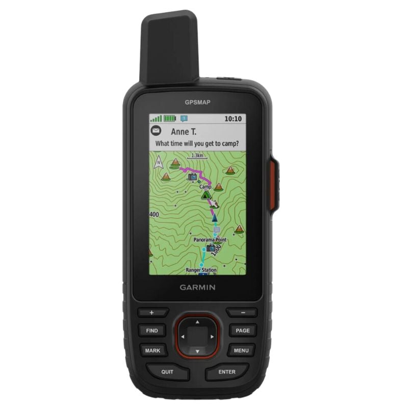
Weight: 8.1 oz / 230 grams
Battery Life: 165 hours in standard mode and 840 hours in expedition mode
Battery Type: Rechargeable battery, built-in Lithium battery
Pros:
> Uses inReach technology for 2-way satellite communication
> Great color screen
> Compass, Altimeter, Barometer
> Very good battery life
Cons:
> Not the cheapest
> Will take a while to learn how to use all the features
The GPSMAP 67i is the unit I recommend to most backpackers, and it is the one that has aged best in Garmin’s lineup. It took the 66i body and dropped in a much better chipset, which is why the battery figures jumped from 35 hours of tracking to 165 hours, and from around 200 hours in expedition mode to 840. That is the difference between charging every few days and charging once a week on a long carry.
The important part is multi band reception. In canyons and under heavy tree cover the 67i holds a position where older single band units wander, and that is exactly where a handheld is supposed to beat a phone. You also get inReach hardware built in, so SOS, two way messaging and weather all work off one device with no extra purchase, only a subscription. Considering the features, it could replace a Hiking Watch, PLB, and a Hiking Compass (although you should always carry a compass).
It suits long distance hiking, off trail travel, shoulder season trips and any route where the weather turns and you want buttons instead of a wet screen. The learning curve is real, and the menu structure will take a few trips to internalise. The 3 inch screen also looks small next to the newer flagship, though it is bright and readable in sun.
Trade off: you pay a lot and you carry 230 grams to get accuracy and battery life your phone cannot match.
Best for: thru hikers and backpackers who want one device for navigation, tracking and satellite messaging.
Compare Prices:
Best Premium Hiking GPS
Garmin GPSMAP H1i Plus
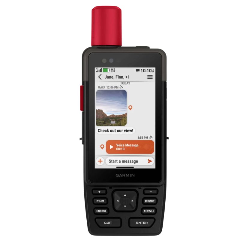
Weight: 10.2 oz / 290 grams
Battery Life: up to 145 hours in GPS mode, up to 840 hours in expedition mode
Battery Type: Rechargeable built-in Lithium battery
Pros:
> Offers a slate of features that allow you to stay incredibly safe throughout your trek.
> The sturdy build will withstand the elements and accidental drops onto through terrain.
> The Large touchscreen display makes it easy to read all the information.
Cons:
> The screen could be a bit brighter
> Not Cheap
The H1i Plus is Garmin’s new flagship handheld GPS which is the best on the market right now. I rate this product better in every way than the 67i with the exception of price, weight and features that not everyone needs, hence the 67i taking out the top spot.
The headline feature is a built in camera and microphone, so you can send a photo or a voice note over satellite without pulling out a phone. On a rescue call or a route finding problem that is genuinely useful, and it is the first handheld to offer it. If you want the best with all the features, this is for you. Your only question will be is it worth the extra price!
The hardware is the nicest in the range. You get a 3.5 inch touchscreen with physical buttons as a backup, which is the layout everyone including myself have wanted from Garmin for years. The extremely large 64 GB of memory means you can load a whole country of topo maps.
It suits well funded expedition use, guiding work, search and rescue volunteers, and anyone who wants photo and voice messaging from the backcountry. For a standard thru hike it is hard to justify.
If you want the same platform without photo and voice in-reach, the plain GPSMAP H1 saves a couple of hundred dollars.
Trade off: the best handheld hardware Garmin makes, at a price and weight that most backpackers do not need.
Best for: expedition trips, guides and photographers who will actually use satellite photo and voice messaging.
Compare Prices:
Best Hiking GPS with Satellite Messenger
Garmin InReach Mini 3 Plus
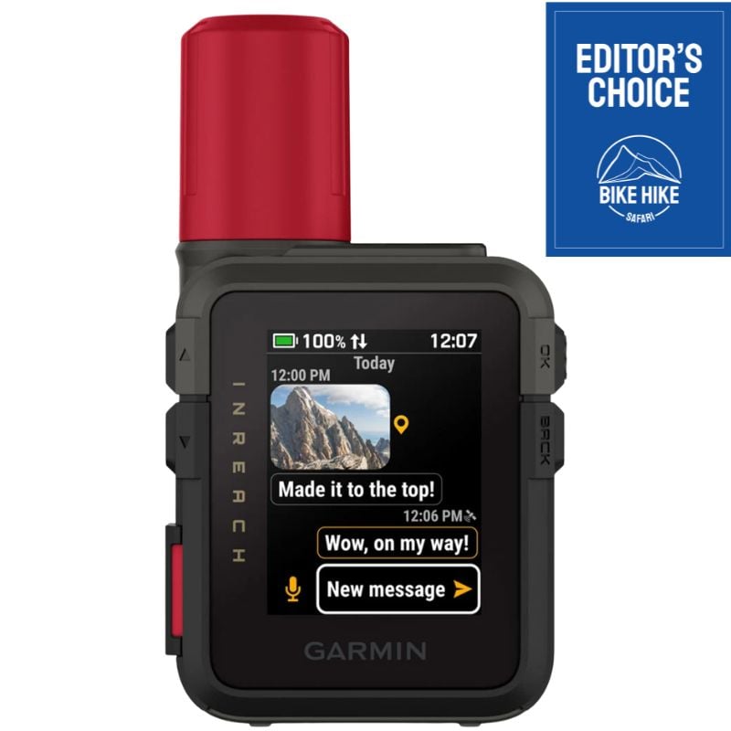
Weight: 4.3 oz / 123 grams
Battery Life: between 6 days and 35 days
Battery Type: Lithium Rechargeable battery
Pros:
> Ultra lightweight
> Very Good battery life
> Small size
> 2-way communications including photos and voice messages
Cons:
> Small Screen
> Need a subscription to use the features
The Mini 3 Plus replaces the inReach Mini 2 that most guides, including this one, have recommended for years. The battery is the real story, up from 336 hours to around 350 hours of 10 minute trackingor 35+ days when in expedition mode. The screen finally goes colour and touch, which makes reading a message far less painful than scrolling the old monochrome strip.
It has also gained weight. The Mini 2 was 100 grams and the Mini 3 Plus is around 123 grams, so ultralight hikers counting every gram should know that up front. In return you get photo messaging on the Plus model, which the standard Mini 3 does not have.
Where it fits is simple. I rate this as the best satellite messenger with basic navigation, not a mapping GPS. There are no topo maps and the screen is too small to navigate from properly, so most people carry it alongside a phone with offline maps. That combination is lighter than a full handheld and covers both jobs.
It suits thru hikers, solo hikers, bikepackers and anyone whose main reason for carrying a device is SOS and staying in contact. If you already own a Mini 2 there is no urgent reason to upgrade, and the discounted Mini 2 remains good value while stock lasts.
Trade off: satellite safety and messaging at low weight, with no real mapping.
Best for: thru hikers and solo hikers who want SOS and two way messaging in the smallest sensible package.
Compare Prices:
Best Budget Hiking GPS [Currentyear]
Garmin e Trex SE

Weight: 5.5 oz / 156 grams
Battery Life: 7 hours in standard mode and 75 days in expedition mode
Battery Type: AA Batteries
Pros:
> Lightweight
> Compact size
> Simple to use and best suited for beginners
> Accurate GPS
> Reasonably priced
Cons:
> Lacking features such as a color screen
The eTrex SE is the best value handheld Garmin sells and the unit I point beginners towards. It runs the modern multi satellite receiver found in the expensive models, so raw position accuracy under canopy is far better than the price suggests, and it does that on two AA batteries you can replace anywhere.
Battery life is the standout. 168 hours in standard mode on a set of AAs, and up to 1800 hours in expedition mode, means you can walk for weeks on a couple of sets of lithium AAs without carrying a power bank for it. On a long trail that is a real weight saving once you account for the charging gear you no longer need.
The compromises are the screen and the maps. It is monochrome, and it cannot store downloadable topo maps or Garmin satellite imagery, so you are working with a basemap, waypoints, tracks and a compass. It will tell you exactly where you are and get you back along your track, but it will not show you the terrain the way a 67i does.
It suits budget minded hikers, anyone wanting a lightweight backup to a phone, and beginners who want position and breadcrumb navigation without a menu system to learn.
Trade off: excellent accuracy and battery life for the money, with no colour and no real maps.
Best for: beginners and hikers who want a cheap, reliable backup to phone navigation.
Compare Prices:
Best GPS for long trails with no Backup Battery
Garmin eTrex SE Solar
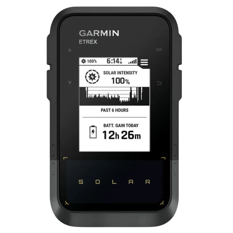
Weight: 5 oz / 141 grams
Battery Life: 200 hours in GPS mode and 1800 hours in expedition mode, unlimited with full bright sun
Battery Type: Rechargeable built-in Lithium battery and solar
Pros:
> Potentially unlimted battery life.
> Lightweight
> Great price for
Cons:
> No color screen
> Is the extra $100 worth it just for the solar
The eTrex Solar answers a problem thru hikers actually have, which is keeping electronics alive between resupplies. Garmin claims unlimited battery life in bright conditions, and while that assumes a lot of direct sun, the practical effect is that a unit clipped to the top of your pack in open country tops itself up as you walk.
Even without sun the numbers are good, up to 200 hours of GPS only tracking and up to 1800 hours in expedition mode. Add multi band reception and you have accuracy on par with much more expensive units.
Like the rest of the current eTrex line it has almost no memory, so there are no downloadable topo maps and no satellite imagery. Treat it as a position, waypoint and track device that pairs with a phone or paper maps rather than a full mapping GPS.
It suits long trails with big carries, desert and alpine sections where sun is plentiful, and bike touring where the unit sits exposed on a handlebar bag all day. Under dense forest canopy the solar contribution drops, so do not plan around it on a wet coastal trail.
Trade off: near endless battery in good light, at the cost of maps and screen quality. Most hiker carry a lightweight battery bank or solar charger to charge phones and headlamps.
Best for: long distance hikers and bike tourers who want to stop carrying a power bank for navigation.
Compare Prices:
Best Large Screen Hiking GPS
Garmin Montana 710i
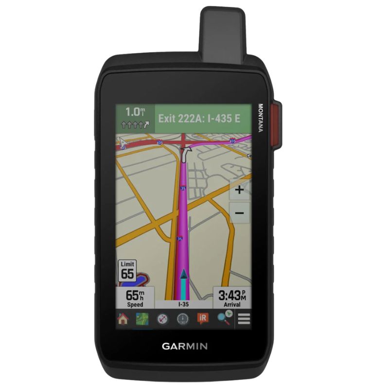
Weight: 14.5 oz / 410 grams
Battery Life: 24 hours in GPS mode and 440 hours in expedition mode
Battery Type: Rechargeable built-in Lithium battery
Pros:
> Full feature Hiking GPS
> The most durable GPS is this review
> Great Large touchscreen display
Cons:
> Features such as weather and 2-way communications require a subscription
> Not Cheap
The Montana 710i is the biggest, toughest and most readable unit here. The 5 inch touchscreen shows a map the way a phone does, the build is military tested against drops and water, and it carries the full sensor set with a barometric altimeter, barometer and electronic compass. It also has inReach built in, so you get SOS and two way satellite messaging on a subscription, along with inReach weather.
The public land boundary overlay is a genuinely useful feature that no other unit here matches, and it matters if you hike in the United States where access can change from one ridge to the next.
Where it does not belong is a thru hike. At 410 grams it is heavier than three inReach Mini 3 Plus units, and 18 hours of GPS mode battery life is the shortest in this guide. Its natural home is a vehicle dash, a hunting trip, a basecamp, or bikepacking on a powered mount where weight and charging are less critical.
If you do not want the satellite subscription, the plain Montana 710i drops the inReach hardware and the ongoing cost.
Trade off: the best screen and the toughest build, with the worst weight and battery life for hiking.
Best for: vehicle based travel, hunting, basecamp navigation and anyone who wants a large touchscreen map.
Compare Prices:
More Backpacking GPS Units to Consider
Garmin eTrex 32x

Weight: 5 oz / 142 grams
Battery Life: 25 hours in GPS mode
Battery Type: 2 x AA batteries
Pros:
> Built for adventure, with geocaching features and satellite images to entice exciting hiking.
> Crisp and clear screen is easy to read in all conditions, and won’t be affected by rain or snow.
> Small and compact construction makes it easy to transport without hassle.
Cons:
> Small size may make it slightly easier to lose if not securely tied down, or stored away.
The eTrex 32x is the small mapping handheld that has been in packs for a decade, and it still does the basics well. You get a colour screen that stays readable in direct sun, 8 GB of memory with a microSD slot so you can load topo maps, a barometric altimeter and a three axis compass, and AA power.
To correct a point that has appeared on this page before, the eTrex 32x is a button driven unit. There is no touchscreen. That is an advantage in rain, snow and gloves, which is exactly when touchscreens become frustrating, and it is one of the reasons this unit has lasted.
It handles geocaching well, with paperless caches and difficulty ratings stored on the device, and it will show cycling routes if you are bikepacking. Add a Garmin imagery subscription and you get satellite views layered over the map.
The weaknesses are the receiver and the price. It uses GPS and GLONASS without multi band, so accuracy under heavy canopy trails the newer units, and 25 hours per set of AA batteries is modest. At its list price it is poor value next to the cheaper eTrex 22x and the more accurate eTrex SE.
Trade off: proper loadable maps in a small AA powered unit, with older reception and weak value at full price.
Best for: geocachers and hikers who want loadable topo maps on a small budget handheld, bought on sale.
Compare Prices:
Handheld GPS Buyers guide
Handheld GPS Buyers guide
Multi Band GPS and Real World Accuracy
Accuracy is the one thing a dedicated handheld should do better than your phone, and the feature that decides it is multi band reception. Older units listen on a single frequency, which is fine in open country and unreliable in the places where you actually need help, meaning slot canyons, steep sided valleys and dense conifer forest. Multi band units listen on two frequencies across several satellite constellations, which lets them reject signals that have bounced off rock or been distorted by wet canopy.
In practice that is the difference between a track that follows the trail and a track that jumps 30 metres sideways every few minutes. Independent testing has put current multi band Garmins at roughly two to three metres of accuracy in canyons and heavy tree cover, where older units drifted considerably further. If a track log matters to you, either because you are recording a route for other people or because you are navigating off trail, treat multi band as the first thing you check on a spec sheet.
Two habits improve accuracy on any unit. Give it a few minutes at the trailhead with a clear view of the sky before you start recording so it can reach a suitable amount of sattelites. And carry the unit with the antenna upright and unobstructed rather than buried in a pack, since a body or a wet pack lid between the antenna and the sky costs you more accuracy than any setting.
Battery Life and How You Recharge on Trail
Battery numbers on a box are measured in ideal conditions, and the mode matters enormously. A GPSMAP 67i claims 180 hours in GPS mode but around 165 hours with inReach tracking running, and both figures collapse if you leave the backlight high, the compass on and Bluetooth connected. Cold weather takes another bite out of lithium capacity, so a winter trip is not the place to plan on the maximum figure.
Expedition mode is the setting most hikers ignore and should use. It wakes the receiver at long intervals, logs a point, and goes back to sleep, which is why the same unit can claim 180 hours in normal use and 840 hours in expedition mode. You lose live navigation, so it suits recording a route on a trail you can follow by eye and switching back to full mode when you need to navigate.
The practical question is how you top up. Most hikers carry a power bank for backpacking and charge everything in the evening, and a unit with 165 hours of runtime rarely draws from it more than once a trip. If your carries between towns run past a week, or if you hike where power is unreliable, a unit that takes AA batteries or charges from sunlight removes a whole failure mode from your kit list.
AA Batteries vs Built In Lithium vs Solar
There are three power philosophies in the current lineup and each suits a different kind of trip.
Built in lithium units like the 67i and the H1i Plus give you the longest single charge runtime and USB C charging, and they are the right answer for most trips because 165 hours covers a week of navigation. The downside is that a dead battery is a dead unit until you find power, and sealed cells lose capacity over years of use.
AA and AAA units like the eTrex SE, the GPSMAP 65s and the Foretrex 801 trade runtime per set for the ability to fix the problem anywhere. A set of lithium AAs bought at a general store in a trail town will outlast alkalines by a wide margin, they work far better in the cold, and you can warm spares in a jacket pocket. On long remote trips, and on winter trips especially, that flexibility is worth more than headline runtime.
Solar charging, which is currently only on the eTrex Solar, sits between the two. In open sunny country it genuinely means you stop thinking about charging the GPS at all. Under a wet forest canopy the contribution shrinks to a trickle, so buy it for the terrain you actually walk in rather than for the marketing claim.
Screen, Buttons and Touchscreen in Bad Weather
Screen choice is a weather decision more than a comfort decision. Touchscreens are quicker for panning a map and typing a message, and the newer units combine touch with physical buttons, which is the best arrangement available. But a wet touchscreen misreads inputs, and a touchscreen with rain running down it often needs wiping before it responds. Gloves make it worse unless they have conductive pads.
Buttons are slower and they always work. Cold hands, thick gloves, driving rain, snow, none of it matters, and you can operate a button unit by feel without looking at it. That is why the GPSMAP 67i and the 65s remain popular with people who hike in genuinely bad weather, and why the button only eTrex line has survived so long.
Screen size drives weight, battery drain and how much map you can see at once. A 5 inch Montana shows terrain like a phone and weighs 410 grams. A 3 inch GPSMAP shows enough map to make a decision and weighs 230 grams. A 1.9 inch inReach screen is for reading messages, not for navigating. Sunlight readability matters more than resolution, and transflective screens stay legible in bright sun where a phone washes out.
Maps, Memory and Loading Free Topo Maps
This is where the current lineup splits cleanly. The GPSMAP 67i and Montana units have 16 GB while the GPSMAP H1i has 64 GB and accept loadable topographic maps and satellite imagery. The current eTrex units, including the SE and the Solar, have around 28 MB and cannot store real maps, so they show a basic basemap, your waypoints and your track. Both approaches work, but they are different tools, and buying the wrong one is the most common mistake I see.
If you want maps, you do not have to pay Garmin for them. Free OpenStreetMap based topographic maps for most countries can be downloaded and installed with Garmin MapInstall or by dropping the map file onto the device storage, and they are good enough for trail navigation nearly everywhere. Check that your model supports added maps before you buy, because the low memory units do not.
Custom maps are worth learning if you plan complex trips. Tools that let you export a georeferenced image or a custom map tile set will put your own route planning, land boundaries or scanned paper maps onto the device. Load maps and routes before you leave home, on a real screen, because building a route on a 3 inch display at a trailhead is miserable.
Satellite Messaging, SOS and Subscription Costs
Satellite messaging and GPS navigation are two different jobs and it is worth being clear about which you are buying. A GPS tells you where you are. An inReach or similar device sends a message or an SOS through a satellite network when there is no cell coverage. Some units, including the 67i, the H1i Plus and the Montana 710i, do both.
The hardware price is only part of the cost. inReach devices require an active subscription to send anything, including SOS, and plan prices run from a basic tier suitable for occasional trips to unlimited messaging plans that cost meaningfully more per month. Annual plans are cheaper per month than freedom plans you switch on and off, but freedom plans suit hikers who only need coverage for a few months a year. Budget for this before you buy, and check current pricing, because it changes.
For a thru hike the calculation usually comes down to two setups. Either one unit that does everything, which means a 67i or similar, or a phone with offline maps plus an inReach Mini 3 Plus, which is lighter and gives you a better map screen at the cost of relying on the phone. I have used both and the second combination wins for most long trails.
Weight and Whether a GPS Earns Its Place
Every gram has to justify itself on a long trail, and a handheld GPS is not automatic. A phone with offline maps weighs nothing extra because you are carrying it anyway. Adding a 230 gram handheld, or 410 grams for a Montana, has to buy you something real.
What it buys is reliability. A dedicated unit holds a position under canopy where a phone struggles, survives being dropped on rock and rained on, runs for days rather than hours, works in cold that shuts a phone down, and keeps working when your phone gets wet or broken. On a trip where a navigation failure is serious, that redundancy is the point.
The range runs from around 108 grams for a Foretrex, to 125 grams for an inReach Mini 3 Plus, to 141 to 156 grams for the eTrex units, to 217 to 230 grams for the GPSMAP line, to 290 grams for the H1i Plus and 410 grams for a Montana. In most cases, when you are on a marked trails in fair weather a phone plus a light messenger is enough. Off trail, in winter, or on remote routes, carry the full handheld and stop counting those grams.
Durability, Water Rating and Cold Weather
Most handhelds here carry an IPX7 or IP67 rating, which means submersion in about a metre of water for around 30 minutes. That is enough for rain, snow, a dropped unit in a creek crossing and a wet pack. It is not a diving rating and it degrades as seals and battery doors age, so check the gasket on an older unit before a long trip.
The units built to MIL STD 810, including the GPSMAP 67i, the H1i Plus, the Foretrex 801 and the Montana line, add tested drop and thermal resistance. In practice a handheld is far more likely to survive being dropped on rock than a phone is, even if the phone is in a case.
Cold is the underrated factor. Lithium capacity drops noticeably below freezing, screens get slow, and touchscreens become useless with gloves. If you hike in winter, favour a button driven unit and consider AA power so you can swap in warm cells from an inside pocket. Keeping the unit inside a jacket between navigation checks does more for battery life in winter than any software setting.
Handheld GPS vs GPS Watch vs Phone
The category has real competition now and pretending otherwise helps nobody. A modern GPS watch with offline topo maps, multi band reception and a solar face will navigate a marked trail perfectly well and weighs nothing on your wrist. The limitation is the screen. Making route decisions on a 1.4 inch display in bad weather is slow, and the same watch has to survive your whole trip on one charge if you are counting weight.
A phone with a good app is the best map screen you will carry, and it is free because it is already in your pocket. The weaknesses are battery drain, fragility, cold shutdowns, and water. Mitigate those with a rugged case, a power bank and downloaded maps, and a phone covers most fair weather trail navigation.
A dedicated handheld wins on battery life, weatherproofing, buttons, drop resistance and, on multi band models, accuracy under canopy. My honest position is that most hikers on marked trails need a phone and a light satellite messenger. Hikers going off trail, hiking in winter, guiding, or working in remote country want the handheld. If you are weighing up the watch option, see the best hiking watch review.
Price and Value
Prices in this category span nearly a factor of seven and the value curve is not linear.
Under about $200 you get the eTrex SE and eTrex 22x. Both are honest units. The SE gives you modern accuracy and enormous AA battery life without maps, and the 22x gives you loadable maps with an older receiver. For a backup device or a first handheld, this is where I would spend.
Between about $250 and $350 sit the eTrex Solar, the eTrex 32x and the Foretrex 801. Each solves one specific problem, which is charging, geocaching and hands free navigation respectively. Buy in this band for a reason, not by default, because the eTrex 32x in particular looks poor value at full list price.
Between about $500 and $700 the GPSMAP 67i is the best value in the entire category. Multi band accuracy, real maps, 165 hours of tracking and built in satellite messaging in one 230 gram unit is what most serious backpackers actually need, and the subscription is the only ongoing cost.
Above $900 the H1i Plus buys you a bigger touchscreen, more memory, and satellite photo and voice messaging. Testing suggests it does not beat the 67i on core accuracy, so it is a features purchase, not a performance one. Whatever you buy, factor the inReach subscription into the real cost, because over three years the plan can cost as much as the hardware.
Conclusion
The Best Handheld GPS for Hiking and Backpacking in 2026 are:
- Best overall hiking GPS: Garmin GPSMAP 67i
- Best premium handheld GPS: Garmin GPSMAP H1i Plus
- Best ultralight satellite messenger: Garmin InReach Mini 3 Plus
- Best budget: Garmin eTrex SE
- Best for long trails without power: Garmin eTrex Solar
- Best touchscreen with in-Reach: Garmin Montana 710i
- Best value alternative: Garmin eTrex 32x
Follow along on Social Media
Frequently Asked Questions
What is the best hiking GPS for backpacking?
The Garmin GPSMAP 67i is my pick for most backpackers. It combines multi band accuracy, loadable topo maps, around 165 hours of battery with inReach tracking and built in two way satellite messaging in a 230 gram unit. If you want the lightest setup instead, pair a phone running offline maps with a Garmin inReach Mini 3 Plus.
Is a handheld GPS still worth it now that phones have offline maps?
For marked trails in fair weather, a phone with downloaded maps and a power bank is usually enough. A handheld earns its place when conditions get serious. It runs for days rather than hours, keeps working in rain and cold that shuts a phone down, survives drops on rock, and on multi band models holds a position in canyons and heavy forest where a phone drifts.
How accurate is a handheld GPS?
A current multi band unit is typically accurate to around two to four metres in the open and holds up well under tree cover and in canyons, where older single band units can wander much further. You improve on that by letting the unit acquire satellites for a few minutes at the trailhead, keeping the antenna upright and clear, and calibrating the barometric altimeter if the unit has one. Treat GPS elevation as approximate.
Do I need to pay a subscription for a hiking GPS?
Only for satellite messaging. Navigation, maps, waypoints and track recording all work with no ongoing cost. If you buy an inReach capable unit such as the 67i, the H1i Plus, the Montana 710i or the inReach Mini 3 Plus, you need an active plan for SOS and messaging to work at all. Check current plan pricing, and compare annual plans against month to month options if you only hike seasonally.
AA batteries or a rechargeable GPS for a thru hike?
Rechargeable units give you far more runtime per charge, which is why a 67i can cover a week of navigation on one battery. AA units like the eTrex SE and the GPSMAP 65s give you the ability to fix a dead unit anywhere, they work better in the cold, and lithium AAs last much longer than alkalines. On long remote carries and winter trips I lean towards AA power. On everything else, rechargeable.
Does a hiking GPS need wifi or cell service?
No. Maps are stored on the device and position comes from satellites, so it works with no signal of any kind. Wifi or a phone connection is only used for map updates, syncing routes and downloading software, and Bluetooth is used to pair with a phone app. Satellite messaging on inReach models uses its own satellite network, not cell service.
Can a GPS watch replace a handheld GPS?
For many hikers, yes. A current multi band watch with offline topo maps navigates a marked trail well and adds no carried weight. The compromise is the small screen, which makes route decisions and map reading slow, and battery life if you also want to record every day of a long trail. Off trail navigation and bad weather still favour a handheld with a bigger screen and buttons.
BikeHikeSafari Gear Review Process
The author, Brad McCartney from BikeHikeSafari is a small independent adventurer and outdoor gear tester who owns and runs BikeHikeSafari.com.
BikeHikeSafari is not part of a large blog network and is proudly independent. All reviews on this site are independent and honest gear reviews of outdoor products by the author.
The author, Brad McCartney is a very experienced triple crown thru-hiker, adventurer, and bike tourer having spent 1000s of nights sleeping in a tent and sleeping bag (Read more). He was a manager of an outdoor retail store and is very experienced in what is important when using and testing gear for reviews like this.
BikeHikeSafari will never receive any money for reviews and they do not accept sponsored reviews on this website. All the comments about the gear reviews are from the author based on his years of experience. Hope this independent review was helpful for you.

