

I was hiking alone in the New Zealand backcountry when a PLB brought a helicopter to a remote hut in around two hours for an injured hiker. This is a guide for serious hikers, backpackers, thru-hikers, and bikepackers who want to be informed about which PLB or two-way satellite messenger is best. It separates a registered 406 MHz personal locator beacon from a two-way satellite messenger because they solve different problems when you are well beyond phone service.
I am a Triple Crown thru-hiker, former police officer trained in Search and Rescue, and former outdoor retail manager, so I look understand the rescue and have been involved in several. My top satellite messenger for 2026 is the Garmin inReach Mini 3 Plus, while the Ocean Signal RescueMe PLB1 remains my straightforward PLB choice. Weight, battery strategy, and subscription cost matter, but reliable SOS use and clear sky view matter more.
Start with my Quick Picks below, then read the detailed reviews further below. For how I research and review gear, see the BikeHikeSafari Gear Review Policy.
Quick Picks: Best PLB and Satellite Messengers
- Best overall satellite messenger: Garmin inReach Mini 3 Plus : I would choose this for a long hike when I want two-way SOS and messaging in a small standalone device. It is a commercial Iridium messenger, not a PLB, and it supersedes the Mini 2.
- Best PLB for backpacking: Ocean Signal RescueMe PLB1 : I would carry this when I want a registered 406 MHz emergency beacon without a subscription or a rechargeable-device routine. It has no messaging, tracking, or weather.
- Best battery and value in a two-way messenger: Garmin inReach Messenger : The 113.9 g Messenger puts a long stated tracking life and two-way Iridium communication ahead of a larger screen or advanced navigation.
- Best for photos and voice messages: Garmin inReach Messenger Plus : I would pay the weight and plan premium only when sending photos or voice messages from the trail has a real purpose. Its Plus messaging is still a paid inReach service.
- Best for full navigation and SOS in one unit: Garmin GPSMAP H1i Plus : This is for hikers who genuinely want robust mapping and inReach communication together, not for an ultralight kit that already has an offline-phone navigation system.
- Best phone-centric messenger: Zoleo Satellite Communicator : Its two-way messaging moves between satellite, cellular, and Wi-Fi, but I would keep a charged phone and power bank because the phone is where most of its communication experience lives.
- Best for organised groups: ACR Bivy Stick : The group-tracking function and low official weight make sense for a coordinated group that accepts phone reliance for two-way typing.
- Best display-equipped PLB alternative: ACR ResQLink View : Choose it only if a status display and coordinate readout are worth more bulk than the PLB1. It remains an SOS-only 406 MHz PLB, not a text messenger.
How We Tested
The PLBs and satellite messengers in this guide are researched and, where possible, assessed by an experienced long-distance hiker, former outdoor store manager and Police Office. Across thru-hikes, shoulder-season trips, and bikepacking trips, I judge these devices on SOS workflow, network coverage, messaging without a phone, battery strategy, waterproofing, weight, durability, navigation value, and subscription cost for serious backpacking. I was trained in Search and Rescue while working as a police officer in remote areas, which shapes how I look at registration, accidental activation, and the handoff from an emergency signal to local rescue services. Products are selected independently, and I do not accept sponsored reviews (unlike some other review sites). For more on how I research and review gear, see the BikeHikeSafari Gear Review Policy.
Follow along on Social Media
PLB and Satellite Communicator Comparison Table
| Brand | Type | Weight | Battery Life | 2-Way Communications | Waterproof |
|---|---|---|---|---|---|
| Ocean Signal RescueMe PLB1 | PLB | 4 oz | 7 years | No | Yes – 15m |
| ACR ResQLink View PLB | PLB | 5.3 oz | 5 years | No | Yes – 10m |
| ACR ResQLink 400 PLB | PLB | 5.28 oz | 5 years | No | Yes – 10m |
| Garmin InReach Mini 3 Plus | PLB, 2-Way Messaging, photo and voice message sharing | 4.3 oz | up to 350 hours | Yes | Yes – 1m |
| Garmin InReach Mini 3 | PLB, 2-Way Messaging | 4.3 oz | up to 350 hours | Yes | Yes – 1m |
| Garmin inReach Messenger | PLB, 2-Way Messaging | 4 oz | up to 672 hours | Yes | Yes – 1m |
| Garmin inReach Messenger Plus | PLB, 2-Way Messaging, photo and voice message sharing | 4.1 oz | up to 600 hours | Yes | Yes – 1m |
| Garmin GPSMAP H1i Plus | PLB, 2-Way Messaging, photo and voice message sharing | 10.2 oz | up to 425 hours | Yes | Yes – 1 m |
| Zoleo Satellite Communicator | PLB, 2-Way Messaging | 5.3 oz | up to 200 hours | Yes | Yes – 2m |
| ACR Bivy Stick | PLB, 2-Way Messaging | 3.5 oz | up to 120 hours | Yes | Yes – 1 m |
| Spot X | PLB, 2-Way Messaging | 7 oz | up to 240 hours | Yes | Yes – 1m |
| Spot 4 Satellite GPS Messenger | PLB, 2-Way Messaging | 5 oz | up to 52 days | Yes | Yes – 1m |
Best Personal Locator Beacons 2026
Best PLB Beacon for Backpacking
Ocean Signal RescueMe PLB1
Weight: 4 oz / 116 grams
Pros:
> Small and Lightweight
> Ease of use
> 7-year battery life
> Reasonable Price
Cons:
> No two-way messaging, you can only send out a rescue signal.
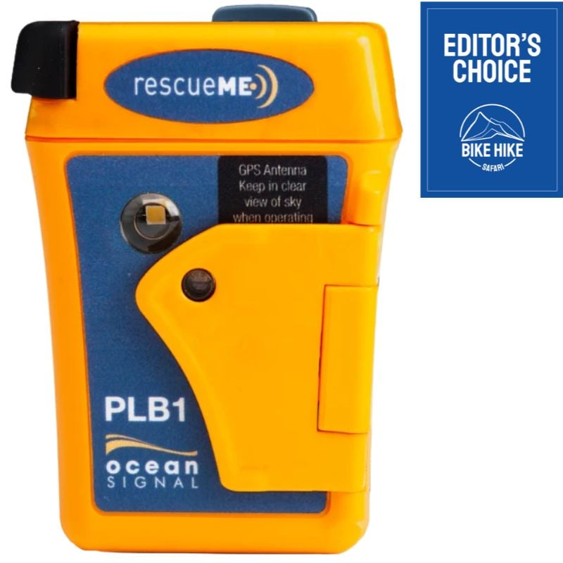
The rescueME PLB1 is the one I would choose when I want a dedicated personal locator beacon rather than a messaging device. It is small, simple, and built around one job: send a registered 406 MHz distress alert through Cospas-Sarsat. Ocean Signal states that the PLB1 has a seven-year battery and no subscription charge. I have personal experience with this product and when it comes to a PLB, it is the best choice.
For a solo hiker on a remote section of the Te Araroa, a bikepacker crossing a sparsely travelled region, or anyone who does not want a recurring plan, that simplicity has value. There is no app to pair, no recharge schedule to manage, and no temptation to use it for casual messages.
The limitation is absolute. I cannot tell rescuers what has happened, send a location update to family, ask for weather, or receive a reply. Registration is required and must be kept current. I also make sure the registration contacts know my route and expected return. In the US, registration is free and renews every two years.
Trade off: I gain a sealed long-life emergency beacon and lose all two-way communication. It is not a satellite messenger.
Best for: Hikers and bikepackers who want the cleanest no-subscription SOS tool, and who will properly register it before leaving home.
Compare Prices:
Best GPS display-equipped PLB
ACR ResQLink View PLB

Weight: 5.3 oz / 148 grams
Pros:
> Price
> Floats in water
> Ease of use
Cons:
> No two-way messaging
> This is larger and bulkier than some other PLBs.
The ResQLink View is another basic device, designed to send out a signal in the most distressing of circumstances. It is a true PLB: register it with the appropriate national authority, carry it where the antenna can see the sky after activation, and do not expect check-ins, tracking, or a conversation with a response centre.
I would not frame it as a cheaper alternative to a messenger. The ResQLink View and an inReach solve different problems. This is an emergency-only device with an information display, not a communicator with a screen. It also provides your live GPS co-ordinates which is a handy feature.
Trade off: The display and extra information add complexity compared with the PLB1, without adding messaging or weather.
Best for: A hiker or paddler who specifically values on-device status and coordinate feedback in a no-subscription 406 MHz PLB.
Compare Prices:
More PLB Options
ACR ResQLink 400 PLB

Weight: 5.28oz / 150g
Pros:
> Ease of use
> Infrared and bright LED strobe lights
> Price – No subscription costs, and a cheaper device all around.
Cons:
> Basic – This is an incredibly basic device, with no two-way communication and limited features.
The ResQLink 400 is a genuine 406 MHz PLB with no recurring service plan. ACR lists GPS, 121.5 MHz homing, visible and infrared strobes, a 148 g weight, and 24+ hours of operation. It is a credible emergency-only choice if its form factor and activation controls suit you.
For backpacking, I would be careful not to mistake basic for inferior. A dedicated PLB can be the right choice when I want a registered distress signal that waits in my kit for years. It needs no phone, no active subscription, and no messaging workflow when I am hurt, cold, or exhausted.
Trade off: A capable PLB with clear emergency features, but an accidental-activation concern that I would not brush aside.
Best for: A buyer who has checked the current control layout, understands the risk, and still prefers this model over the PLB1 or ResQLink View.
Compare Prices:
Best Satellite Messenger 2026
Best 2 Way Satellite Messenger
Garmin InReach Mini 3 Plus
Weight: 4.3 oz / 122 grams
Pros:
> Lightweight
> Very Good battery life
> Small size
> 2-way communications including voice messages and photos
Cons:
> Small Screen
> Need a subscription to use the features
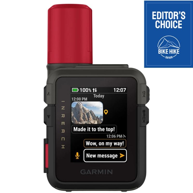
The inReach Mini 3 Plus is the best pick for a compact satellite messenger because it moves the page beyond the discontinued Mini 2 without losing the small standalone format. Garmin offers two-way messaging, interactive SOS, live location sharing, voice messages, photo sharing, USB-C, IP67 protection, and multi-band GNSS in a 122 g unit.
For a thru-hike or remote bikepacking route, I value a device that can send SOS and text without making a phone the only way to communicate. The Plus version also supports photo messages through the Garmin Messenger app and voice messages from the device. That is useful only if the people at home will genuinely benefit from it, not because more features automatically make a safer kit. If you are a young adult thinking of going thru-hiking and have worried parents, you could suggest they purchase this for you so they can have peace of mind that you are safe while you are hiking and backpacking, win-win.
It remains a commercial messenger that needs a satellite subscription for messaging, tracking, weather, and SOS. Garmin says compatible newer devices can retain SOS on a suspended plan only after connection in the Messenger app, so I would set that up before the off-season rather than assume it works.
Trade off: I get a small standalone communicator, but I accept a paid service and a screen that is not a replacement for a full GPS.
Best for: Serious hikers and bikepackers who want current inReach capability, two-way SOS, and a small device that does not depend on a phone for basic communication.
Compare Prices:
Best Non Plus Satellite Messenger
Garmin InReach Mini 3
Weight: 4.3 oz / 122 grams
Pros:
> Lightweight
> Good battery life
> Small size
> 2-way communications
Cons:
> Small Screen
> Need a subscription to use all the features
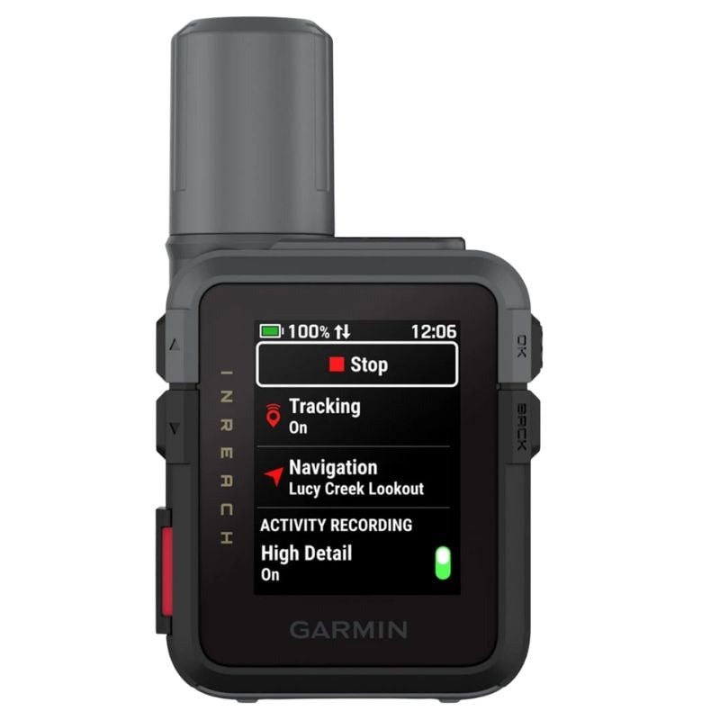
The inReach Mini 3 is the sensible non-Plus choice for a hiker who wants Garmin’s current compact messenger but does not need media messages. It weighs the same 122 g, IP67 protection, USB-C, multi-band GNSS, interactive SOS, location sharing, and up to 350 hours at 10-minute tracking. It is a commercial Iridium messenger, not a registered 406 MHz PLB.
Think of the Mini 3 as the same as the Mini 3 Plus without the ability to send photos or voice messages, and it is about $50 cheaper. It has current Mini 3 hardware and the same stated tracking figure as the Plus version, while the Mini 2 remains lighter on Garmin’s official specification. For a long hike, that makes the Mini 3 a useful current option when I value a standalone device over phone-only communication.
The limitation is clear. Garmin’s comparison says the Mini 3 does not support photo or voice messages. It still handles the functions I consider important on a serious route: two-way text, interactive SOS, tracking, location sharing, and weather with an active inReach plan.
Trade off: I get current Mini 3 capability without paying for Plus media features, but give up photo and voice updates and carry more weight than the older Mini 2.
Best for: Hikers and bikepackers who want a current, compact standalone Garmin messenger for SOS, concise messages, tracking, and weather rather than richer media communication.
Compare Prices:
Best Satellite Messenger for battery and value
Garmin inReach Messenger
Weight: 4 oz / 115 grams
Pros:
> Send and receive messages via the Garmin app on your smartphone
> Compact and Lightweight
> 28 days of battery
Cons:
> Needs a Smartphone to use all the best features.
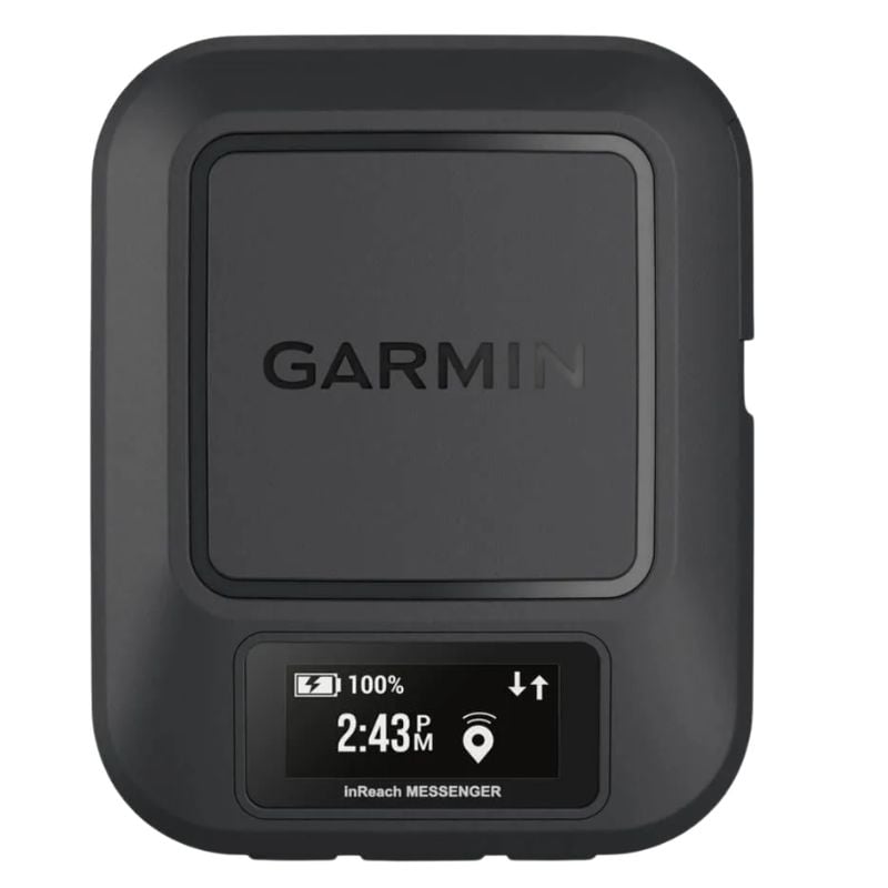
The inReach Messenger is the option I would look at first when reliable two-way communication and stated battery life matter more than a large screen or media messages. Garmin lists it at 113.9 g with up to 672 hours at 10-minute tracking, interactive SOS, tracking, weather, and USB-C charging.
That is a practical combination for a long trail or bikepacking route with infrequent access to power. I can use it for check-ins, a changing itinerary, and a real emergency conversation. It is also lighter than carrying a GPSMAP H1/H1i Plus merely for the SOS feature when my offline mapping is already handled elsewhere.
The Messenger is not navigation-first. It is a communication tool, and the 160-character message limit asks for concise use. I would compare the actual plan terms before buying, because Garmin requires an active satellite subscription for communication features, including SOS, unless the device qualifies for the specific suspended-plan exception.
Trade off: I get excellent stated endurance in a small communicator, but not the Mini 3 Plus display experience or full mapping.
Best for: Thru-hikers and expedition bikepackers who want a current, low-weight inReach with a strong battery emphasis.
Compare Prices:
Best Satellite Communicator for Photos and Voice
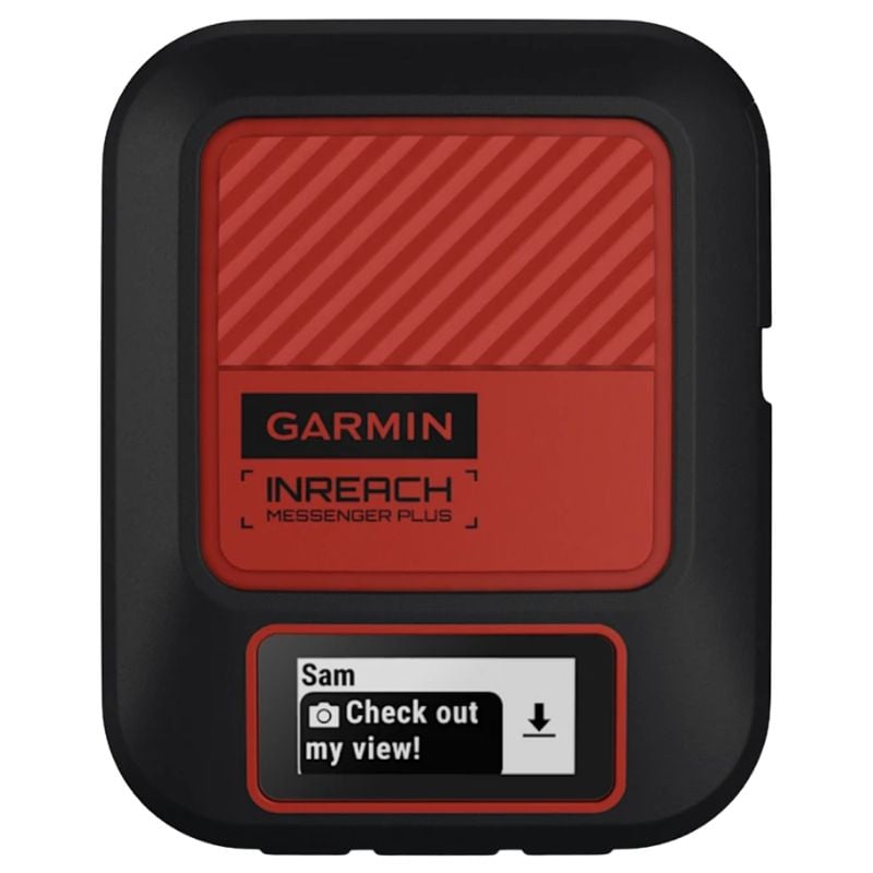
Garmin inReach Messenger Plus
Weight: 4.1 oz / 117 grams
Pros:
> Great battery life of up to 25 days
> Compact and Lightweight
> Great for sending photos and voice messages as well as normal texts and live tracking
Cons:
> Needs a smartphone and subscription to use all the best features
The inReach Messenger Plus is essentially the same as the Messenger above but is more expensive and allows photo and voice messaging with Plus technology.
I see it as a serious remote-travel communicator for people who need richer updates, not a requirement for every hiker. A photo of a river crossing or damage to a bike may be useful to a support person. A short voice message can make an emergency description clearer when typing is slow or difficult.
The cost and battery trade off deserve an honest look. Plus media features still rely on the Garmin Messenger app and a subscription, and standard text remains limited to 160 characters. For many thru-hikers, the non-Plus Messenger is the cleaner choice because a short text and a location are usually enough.
Trade off: I gain photo and voice capability, but pay for features that many lightweight travellers will rarely use.
Best for: Remote bikepacking, guided trips, and long expeditions where richer updates are worth the plan and power cost.
Compare Prices:
Best Navigation GPS, Satellite Communicator and SOS Device
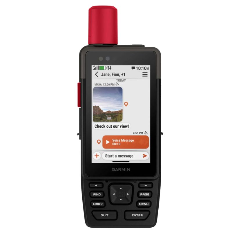
Garmin GPSMAP H1i Plus
Weight: 10.2 oz / 290 grams
Pros:
> Great battery life of up to 425 hours
> Best full map navigation, 2 way communication and SOS device on the market
> Great for sending photos and voice messages as well as normal texts and live tracking
Cons:
> Large and Heavy
The GPSMAP H1i Plus is the premium handheld I would consider when a large touchscreen and physical controls are worth more than keeping the pack as light as possible. Garmin identifies it as a current supported device with dedicated SOS and Action buttons, plus touchscreen and physical controls. It is a navigation handheld with inReach communication, not a 406 MHz PLB.
Its official 290 g weight is 60 g more than the older GPSMAP 67i. That penalty can still make sense for remote bikepacking, expeditions, or a larger GPS interface without relying on a phone.
Battery figures suit long days but need context. Garmin specifies up to 48 hours in performance messaging mode and up to 425 hours in Expedition mode with a message or location every 10 minutes. InReach activation is optional for navigation, but an active subscription is required for inReach services.
Trade off: I gain a current touchscreen GPS with physical emergency controls and inReach communication, but carry 60 g more than the older GPSMAP 67i and still need a plan for inReach features.
Best for: Remote bikepackers, expedition hikers, and navigation-focused travellers who value a premium handheld interface and communication backup over ultralight weight.
Compare Prices:
Best Satellite Communicator for Smartphone
Zoleo Satellite Communicator

Weight: 5.3 oz / 150 grams
Pros:
> Still works if your Smartphone has no battery or is broken
> Compact and Lightweight
> Preset ‘I’m OK’ message
> Reasonably priced
Cons:
> If your smartphone breaks, Zoleo loses much of its originality but still works.
ZOLEO remains the phone-centric messenger I would recommend for a traveller who wants an approachable messaging experience and accepts the phone as part of the system. Its official page lists two-way Iridium messaging, handoff among satellite, cellular, and Wi-Fi, a dedicated SMS number and email, a covered SOS button, and IP68 protection.
The device still handles SOS and check-ins when the phone is damaged or flat, which is an important safety distinction. But two-way typing and the broadest feature set happen in the app, so I would pack a reliable battery power bank on a long hike.
ZOLEO also supports weather forecasts in the app through Xweather. That corrects the outdated claim that it has no weather capability. Its current Prepare plan is $19.99 per month with a three-month minimum, while a paused plan costs $4.50 per month and disables messages, check-ins, and SOS.
Trade off: I get polished phone-based communication and tough waterproofing, but I need to manage a phone, power, and a plan that does not keep SOS active while paused.
Best for: Hikers and bikepackers who want two-way messaging to feel close to normal phone messaging and will maintain phone power.
Compare Prices:
Best Satellite Communicator for Group Tracking
ACR Bivy Stick

Weight: 3.5 oz / 100 grams
Pros:
> Best suited for people who want to send lots of messages per day
> Lightweight and compact
> Dedicated phone number
> SOS can be activated on the device without the need to connect the phone
Cons:
> The lowest-level subscription plan is limited not the best value
The Bivy Stick is worth-considering for organised groups, not as a blanket replacement for every hiker. The Bivy Stick is lightweight, has Iridium coverage, USB-C charging, up to 120 hours of standard operation, and GroupTrack for up to 12 users.
Its strength is the group workflow. I can see the appeal when several riders or hikers are moving together and want a shared tracking system. The device also has a dedicated SOS button, with two-way emergency coordination through Global Rescue.
The phone trade off needs to be clear. By itself, the device can send preset messages, but it cannot provide ordinary two-way communication without the phone. I would not describe it as a PLB or suggest that it provides the same standalone text experience as an inReach Mini 3 Plus.
Trade off: I gain a light group-oriented communicator, but give up phone-free two-way typing and face unresolved water-rating information.
Best for: Organised hiking and bikepacking groups that will use GroupTrack and already have a reliable phone-power routine.
Compare Prices:
Spot X

Weight: 7oz / 198g
Pros:
> Qwerty Keyboard
> Smartphone Integration
> Longer battery life than some similar devices.
Cons:
> Bulky
> Globalstar network does not have as good a coverage as Iridium
The SPOT X is still a legitimate two-way messenger, and its built-in QWERTY keyboard is useful for someone who dislikes composing messages on a tiny button interface. SPOT lists two-way texting to phone numbers or email, Bluetooth, a compass, waypoints, tracking, and IP67 protection.
The weight is the problem for my kind of hiking. At 198.4 g, it is far heavier than a Mini 3 Plus or Messenger. A keyboard does not compensate for that on an ultralight kit unless I will actually send enough phone-free messages to use it.
There have been a couple of incidents when the Spot did not make contact with satellites, including with a hiking buddy of mine. I would take that observation seriously rather than make a blanket claim about every SPOT trip. SPOT uses Globalstar and publishes separate coverage zones with fringe areas for its service. It does not have as good a coverage in arctic areas as Iridium based messengers.
Trade off: I gain direct keyboard messaging, but carry much more weight and accept a network with published fringe-coverage limitations.
Best for: A user who values a physical keyboard more than ultralight weight and has checked the current SPOT coverage map for the route.
Compare Prices:
Spot Gen4 Satellite GPS Messenger

Weight: 5 oz / 142 grams
Pros:
> Lithium batteries make for a quick change in difficult circumstances.
> Ease of use
> Reasonably Priced
Cons:
> No two-way messaging – The device only sends messages, it doesn’t receive them.
It is a one-way tracker with SOS, not a two-way satellite messenger. The SPOT is 142 g weight with lithium batteries, IP68 protection, pre-programmed and custom messages for up to 10 contacts, tracking, and FocusPoint International coordination for SOS.
Replaceable batteries can be attractive on a long route where charging is awkward. I can send a location and an agreed check-in, and my contacts can see that I have reached a camp or resupply point. But they cannot reply, and I cannot use a message exchange to explain an injury or confirm changing plans.
There have been a couple of incidents when the Spot did not make contact with the Globalstar satellite network, including with a hiking buddy of mine on the Appalachian Trail and in the far north of Alaska. SPOT itself marks fringe coverage areas where customers should expect the weakest signal.
Trade off: I get simple tracking and replaceable batteries, but no incoming messages and a network limitation that matters in remote travel.
Best for: Budget-minded users who only need one-way check-ins and have confirmed coverage, not people who expect a conversation during an emergency.
Compare Prices:
PLB & Satellite Communicator Buyers Guide
Buyers Guide: PLB & Satellite Communicator
First decide: 406 MHz PLB or two-way satellite messenger?
A personal locator beacon is a 406 MHz distress beacon operating in the international Cospas-Sarsat system. A PLB sends a distress signal through satellites, ground stations, a Mission Control Center, and then the appropriate rescue coordination chain. It is not a texting product. A Garmin inReach, ZOLEO, Bivy Stick or SPOT X is not a dedicated PLB.
I choose a PLB when I need a dedicated, registered emergency signal with no subscription and no regular charging. I choose a messenger when I need to tell someone what has happened, change a pickup, share a location, receive a reply, check weather, or keep in touch over a long route. Ocean Signal says its PLB1 has no subscription charge, while Garmin requires an active satellite subscription for inReach communication features.
Understand what happens after SOS
An SOS button is not a helicopter guarantee. With a PLB, the beacon begins transmitting a continuous distress signal. Satellite instrumentation detects it, a Local User Terminal processes it, the national Mission Control Center correlates the alert and registration information, and the alert is passed to the appropriate Rescue Coordination Center or Search and Rescue point of contact. A properly registered beacon can speed the investigation because responders can contact the owner or emergency contacts and see the supplied trip information.
Commercial devices use a different routing model. Garmin routes SOS to Garmin Response, Bivy Stick uses Global Rescue, ZOLEO provides 24/7 SOS monitoring, and SPOT uses FocusPoint International. The practical advantage of two-way SOS is that I can state the injury, number of people, shelter, supplies, and changing conditions, then receive confirmation or follow-up questions. It does not make terrain, weather, or rescue resources disappear.
Detection can be fast, especially with current systems, but arrival is variable. NOAA says every rescue is unique and in real world situations rescue can happen within hours or weeks. I plan food, water, insulation, first aid kit, and shelter as if I may have to wait after I press SOS.
My New Zealand PLB rescue story
The weather was miserable when the helicopter arrived due to the Personal Locator Beacon being set off.
It had been raining all day and the wind was seriously strong. I was hiking in the backcountry of New Zealand, alone.
Cold and wet I arrived at a remote backcountry mountain hut. Before entering I observed a Personal Locator Beacon sitting outside with the antenna out and the light on. Something was wrong.
I entered the hut and found a hiker I had met multiple times clutching her shoulder. It was a simple dislocation. In the middle of nowhere, a simple dislocated shoulder means you cannot carry a backpack, you cannot use trekking poles, and cannot walk long distances on difficult terrain to rescue yourself.
In less than 2 hours a rescue helicopter arrived and landed outside the hut despite the challenging weather. The hiker was soon in hospital and made a quick and full recovery.
That experience is why I take the distinction seriously. The PLB connected a serious injury in a remote hut to the rescue system. I would never use one event to promise the same response time somewhere else.
Network and sky view matter more than marketing labels
No satellite device works well from every position. Trees, narrow valleys, steep cliffs, buildings, and the way I hold it can obstruct the sky view. ACR says the Bivy Stick needs sky visibility and cannot obtain a GPS lock indoors. Apple requires a clear view of the sky and horizon, and warns that heavy foliage may prevent connection.
I check the network and coverage map for the actual route. Garmin, ZOLEO, and Bivy Stick use Iridium-based services marketed as global. SPOT uses Globalstar and publishes fringe-coverage zones, including separate SPOT X map detail. A remote route deserves that check, not blind reliance on a brand name.
A 406 MHz PLB uses the international government-supported Cospas-Sarsat distress system. A GPS-equipped beacon gives rescuers a starting location, but I still follow the manual and position its antenna to transmit.
Two-way messaging, phone dependence, and navigation
For a thru-hike, two-way messaging is not only about chatting. It lets me report a non-life-threatening injury, move a pickup, tell a contact I am delayed by weather, and provide rescuers useful facts after SOS. I prefer a standalone device when I do not want a dead or damaged phone to remove my ability to type. The Mini 3 Plus, Messenger, Messenger Plus, and SPOT X can send messages from the device. ZOLEO and Bivy Stick retain SOS capability on the device, but their ordinary two-way experience is largely app based.
A satellite messenger is not automatically my primary navigation tool. A small inReach gives location and tracking, but not the robust mapping workflow I want for a complex route. The GPSMAP H1i is the exception here because it combines mapping and inReach features, at a weight cost. I keep this page focused on its communication and SOS role, then send readers who are shopping for maps, screens, and route finding to the Best Hiking GPS guide.
Battery strategy and waterproofing on long routes
A PLB and a messenger ask for different habits. The PLB1 states a seven-year battery and 24+ hours of operation after activation; ACR lists five-year replacement intervals for the ResQLink 400 and View. I check the expiry date, use only the approved self-test, and arrange professional replacement on time.
I charge a messenger and treat published endurance as planning information, not a cold-weather promise. Garmin publishes up to 350 hours at 10-minute tracking for Mini 3 models, 672 hours for Messenger, and 600 hours low-power tracking for Messenger Plus.
IPX7, IP67, and IP68 ratings describe limited water testing. They do not mean a device transmits while submerged. ACR says the ResQLink 400 will not work under water. I protect ports and carry the emergency device on my body, not buried in a pack.
For rechargeable messengers, I plan power. A small power bank is usually more predictable beneath trees, while a portable solar charger can work on a long exposed bikepacking route.
Subscription cost, tracking, weather, and the off-season
The purchase price is not the ownership cost. Garmin requires an active subscription for messages, SOS, tracking, and inReach weather. ZOLEO requires a subscription, has a $19.99 activation fee and three-month minimum on its currently listed plans, and charges $4.50 per month to pause after that term. A paused ZOLEO cannot send messages, check-ins, or SOS alerts.
Garmin says listed compatible current Mini, Messenger, and GPSMAP H1i devices can retain SOS while suspended if connected in Garmin Messenger. Older devices including the original Mini and GPSMAP 66i cannot. I confirm this before every season.
Tracking and weather help with plans, not judgment. I still use local observation, a conservative turnaround decision, a reliable hiking compass, and a paper map where appropriate. ZOLEO offers Xweather forecasts and Garmin lists inReach Weather.
An important note is these costs and features that are available when the subscription is paused is changing without much notice. Starlink and Apple have teamed up to provide satellite communications when outside cell phone towers. While the technology is not great at the moment, I certainly don’t trust it yet, I suspect that in the not too distant future it may replace most of the items in this review!
Region, registration, and phone satellite backstops
PLB registration is not optional. In the United States, NOAA says it is free, required by federal regulation, active immediately online, and renewed every two years. Registration gives SAR useful owner and emergency-contact information. If I move countries, the beacon needs reprogramming and registration in my new country of residence.
Commercial devices have regional and legal limits. Garmin bars subscriptions in listed sanctioned locations; Apple Messages via satellite is limited to the US, Canada, Mexico, and Japan; T-Satellite is US-only. I check law and coverage before international travel.
My iPhone is a backstop, not my only serious-travel emergency plan. Apple Emergency SOS works on iPhone 14 or later without cellular or Wi-Fi with a clear sky view, but Apple says Messages via satellite should not be used in emergencies.
My decision logic for serious hiking and bikepacking
I start with the consequence of no contact. For short local walks with reliable exit options, a charged phone and shared plan may be enough. For solo hiking, remote bikepacking, off-season travel, severe weather, or terrain where an injury could make self-rescue impossible, I carry an emergency satellite device and a hiking first-aid kit.
I buy the rescueME PLB1 when I want the least complicated registered SOS tool with no plan. I buy an inReach Messenger or Mini 3 Plus when I need two-way communication and plan to use it frequently. I choose the GPSMAP H1i only when I genuinely want robust mapping as well as SOS. I choose ZOLEO when phone-based messaging and tough waterproofing are worth the phone and plan dependence. I do not choose SPOT solely on upfront cost without checking the Globalstar map and accepting the one-way or heavier-device limitations.
Before every departure, I register or update the PLB, charge the messenger, send a test or check-in only as the manual permits, verify the plan, tell a contact the route and return window, carry the device on my body, and rehearse the SOS cover and button without triggering it. False alerts waste rescue resources.
Conclusion
Here are the Best PLBs for 2026:
- Best PLB for backpacking: Ocean Signal RescueMe PLB1
- Best display-equipped PLB alternative: ACR ResQLink View
- Also Worth Considering: ACR ResQLink 400 PLB
Here are the best satellite communicators for 2026:
- Best overall satellite messenger: Garmin inReach Mini 3 Plus
- Best battery and value in a two-way messenger: Garmin inReach Messenger
- Best for photos and voice messages: Garmin inReach Messenger Plus
- Best for full navigation and SOS in one unit: Garmin GPSMAP H1i Plus
- Best phone-centric messenger: Zoleo Satellite Communicator
- Best for organised groups: ACR Bivy Stick
- Also Worth Considering: Spot X
- Also Worth Considering: Spot 4 Satellite GPS Messenger
Frequently Asked Questions
Do I need to register a personal locator beacon?
Yes. In the United States, PLB registration is free, required, and renewed every two years. Online registration becomes active immediately. Register with the responsible national authority in your country of residence and update owner, contact, and trip information when it changes.
Should I buy a PLB or a satellite messenger for a thru-hike?
I would take a satellite messenger if I need check-ins, changing pickup plans, tracking, weather, or two-way SOS communication throughout the hike. I would take a PLB if I want a dedicated registered emergency beacon with no subscription and no routine charging. A PLB is not a text messenger.
How fast will help arrive after SOS?
Satellite detection can be fast, but rescue arrival depends on the location, weather, injury, communication, and available assets. NOAA says every rescue is unique, and field-testing coverage summarises the range as hours to weeks. I press SOS when I need it, then focus on shelter, warmth, hydration, and staying visible.
Does SOS work if I suspend an inReach or ZOLEO plan?
On specified compatible Garmin devices, SOS can remain available while a plan is suspended if the device has been connected in the Garmin Messenger app. Garmin lists the supported models. ZOLEO says a paused plan cannot send SOS alerts, so do not treat a paused ZOLEO as an emergency device.
Is an iPhone 14 or later enough for the backcountry?
It is a helpful backstop, especially for Apple Emergency SOS via satellite, but I would not make it my only emergency plan for serious remote travel. Apple says Messages via satellite should not be used in emergencies, and connection needs a clear view of the sky and horizon.
What should I do if I trigger SOS by accident?
Do not ignore it. Follow the device instructions to cancel when possible and communicate that help is not needed. Apple specifically says to stay in the session and wait for a responder if its satellite Emergency SOS was started accidentally; false alerts waste SAR resources.
Will I be billed for a rescue?
Do not assume a universal answer. SAR itself is free in the US, Canada, Australia, New Zealand and many more but evacuation and medical transport can still create major costs, and SPOT and ZOLEO sell separate rescue or medical-transport coverage. Check the rules, insurance, and service terms for the destination.
Follow along on Social Media


BikeHikeSafari Gear Review Process
The author, Brad McCartney from BikeHikeSafari is a small independent adventurer and outdoor gear tester who owns and runs BikeHikeSafari.com.
BikeHikeSafari is not part of a large blog network and is proudly independent. All reviews on this site are independent and honest gear reviews of outdoor products by the author.
The author, Brad McCartney is a very experienced triple crown thru-hiker, adventurer, and bike tourer having spent 1000s of nights sleeping in a tent and sleeping bag (Read more). He was a manager of an outdoor retail store and is very experienced in what is important when using and testing gear for reviews like this.
BikeHikeSafari will never receive any money for reviews and they do not accept sponsored reviews on this website. All the comments about the gear reviews are from the author based on his years of experience. Hope this independent review was helpful for you.

