
The Port Davey Track is not hiked as often as its nearby neighbour The South Coast Track.
Most people start at Scotts Peak Dam and hike to Melaleuca Airstrip. From there you can fly back to Hobart. If you have the time, a better option is to continue on the South Coast Track to make a continuous 9-13 day hike about 160km in length. To facilitate an easier hike you can organise a food and fuel drop halfway at Melaleuca.
Port Davey Track Transport
Here are your choices for transport to and from the Port Davey Track.
Scotts Peak Dam Transport
Getting to the Scotts Peak Dam to access the hiking trails such as the Port Davey Track and Western Arthurs is difficult. There are several options:
- Hitchhiking – Not easy but that is how I got there
- Driving – private transport or rent a car, there is a large carpark at the trailhead
- Public Transport – try Tasmania Wilderness Experience

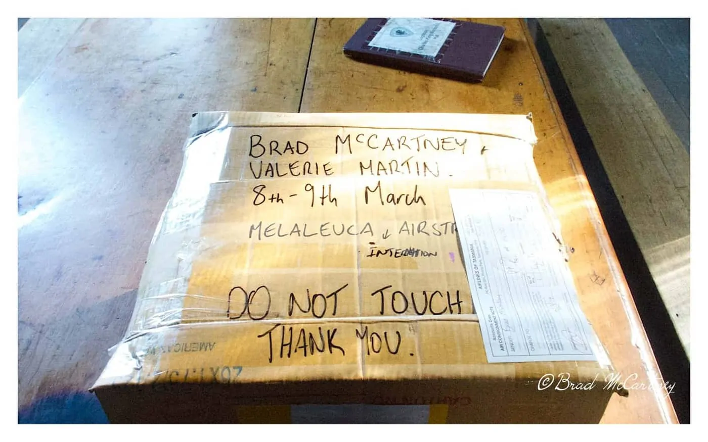
Food and Fuel Drop at Melaleuca Airstrip
Organise to start or finish at Melaleuca Airstrip. and fly with Par Avion.
If choosing to hike the Port Davey Track and South Coast Track you can organise for a food drop to be delivered to the airstrip at Melaleuca by Par Avion.
They fly there regularly with food drops and also sell fuel for all types of stoves. I organised a litre of fuel to be picked up. When I hiked the trail I flew in 11kg of food which included 2 litres of wine and 1kg of fruit cake along with other treats to keep my hiking group motivated.
2025 Edit – The freight/food price is $7 per Kg – ($15 for a 230g gas canister, $8.50 per litre of Shellite or Methylated Spirits)
The food and fuel are stored in a rodent-proof box near the airstrip and hut. Our cardboard box was undamaged when we arrived. After unpacking our food box a pilot arrived and kindly packed our box out for us, including our rubbish. That was not expected but greatly appreciated.

Port Davey Track Gear Guide
A Complete Guide to Lightweight Gear for the Port Davey Track.
Try to pack lightweight if possible. Here are some reviews of the best lightweight and ultralight hiking gear.
- Lightweight Backpack
- Lightweight Tent
- Lightweight Sleeping Bag
- Lightweight Sleeping Mat
- Lightweight Down Jacket
- Lightweight Rain Jacket
Hiking the Port Davey Track
Here is a complete daily journal of my time spent hiking the Port Davey Track. It will give you a bit of an insight into what it is like hiking the Port Davey Track in Tasmania.
Port Davey Track Day 1
The hike started with light rain and drizzle which was only heavy enough to annoy rather than dampen anything. Within a couple of hours, it ceased and the Western Arthur Range came into view. Most people stopped at the campsite at Junction Creek but as it was early so we forded the creek and kept moving. In heavy rain this can be a very sketchy crossing so keep that in mind when fording this creek in heavy rain.
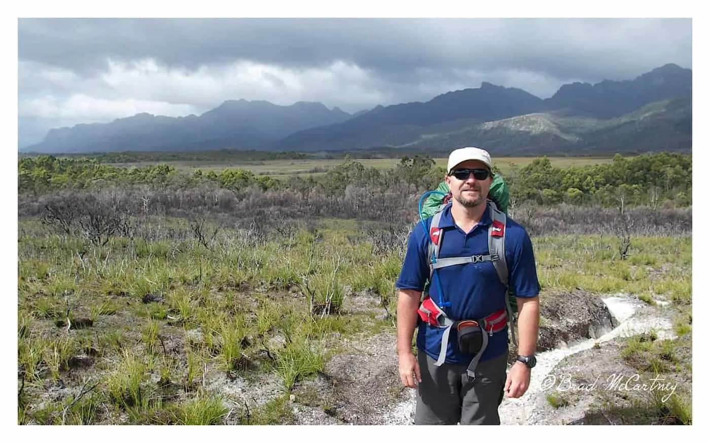


We continued through the glacial sculpted valleys of the Crossing Valley with the White Valley Mountains on the right and the Western Arthur Ranges on the left to our first campsite of the trip at Crossing River. At crossing the river, we had a most interesting meeting with a German couple heading in the other direction.
They advised that they had been hiking for about 28 days from Lune River with lots of side trips. The guy started with a pack weight of 40kg and the girls started with a pack weight of 30kg, mostly cookies. They were in great spirits and very positive in their attitude, even if they looked like they needed a good feed and a week in under a hot shower.
19km in 6.5 hours including all rest stops, lunch breaks, photo and/or video stops, siestas etc
Port Davey Track Day 2
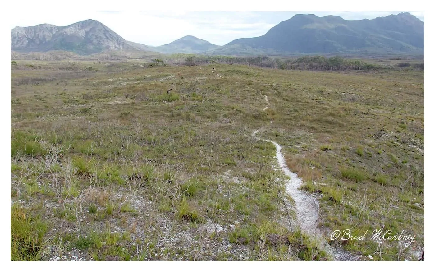
From Crossing River camp there had been some recent fire damage that had made obvious changes to the landscape. It meant that there was easy walking for us as most if not all of the trees and shrubs had been decimated by the fire.
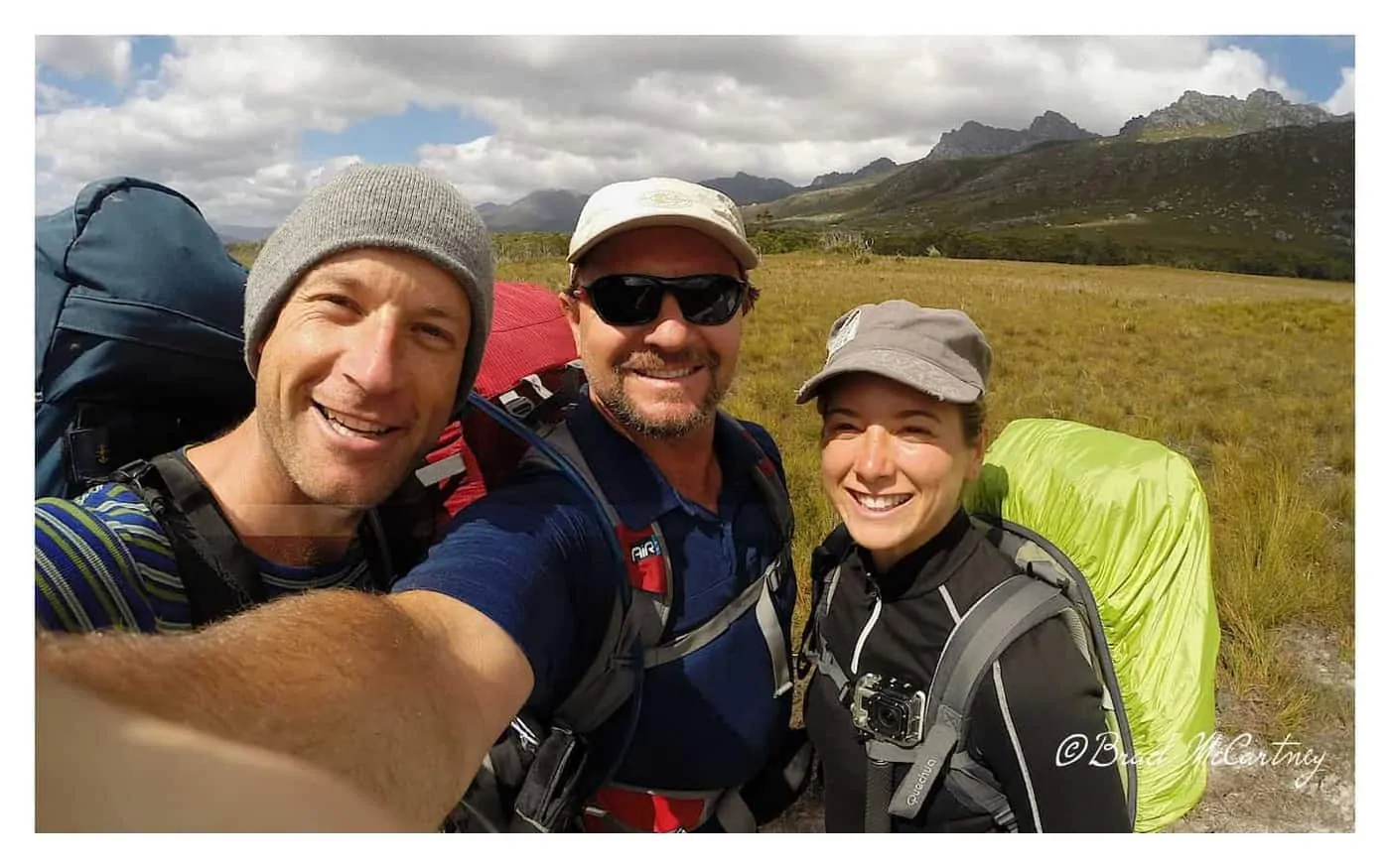
The results meant uninhibited views of the surrounding White Monolith Range and its mountains such as Sculpted Mountain, Wombat Peak, Scrubby Peak and Stonehenge Peak. By lunchtime we reached another campsite, Watershed Creek, we were somewhat surprised to find a German bloke, Sven. He was late in leaving camp, seems like he was taking his time. We took our time over lunch before heading off to the area known as the Lost World Plateau.
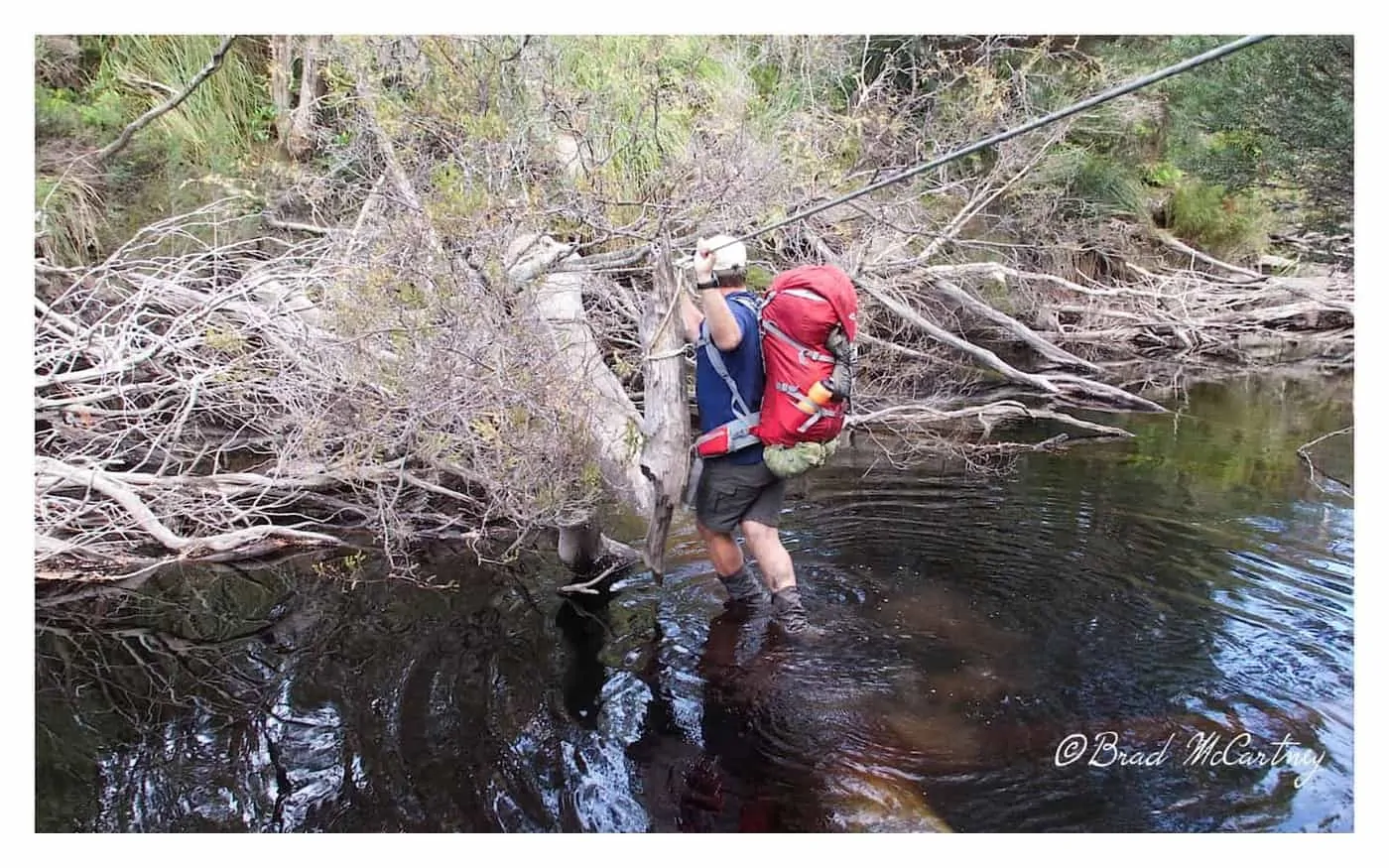
The track was in great condition with easy walking so we decided that we would try and make it to Spring Creek for our overnight camp. As we got closer the area scarred by the fire finished and the track took on a more muddy side. We passed Sven who camped at a small campsite near a flowing creek just off the Lost World Plateau. It was getting late when we reached Spring Creek and we followed the obvious footpaths through the storm-damaged area until the footpaths disappeared.
We backtracked and followed the next most obvious track, they too disappeared. Then a third time we saw the error in our ways and found the track. The river crossing was damaged by a fallen tree. We made it across to find that the marked campsite had been destroyed by trees felled from the storm. Back across the river again to the less than favourable camp. With positive attitudes, we laughed the day off as a long tiring day which made our minor but frustrating errors multiply.
26km 10.5 hours including all rest stops, lunch breaks, photo and/or video stops, siestas and time going in circles!! etc
Port Davey Track Day 3
Once again there was fine weather when we left Crossed Spring Creek again for the 3rd time as we set our sights on camping at Bathurst Harbour by the end of the day. The walking was fine and we temporarily set our sites on climbing Mt Rugby, one of the highest mountains in the area which promised great views of the surroundings. As we approached we decided that it would be more prudent to give it a miss for now and continue to Farrell Point on the North Side of Bathurst Harbour. The track up Mt Rugby looked non-existent, at least we couldn’t easily find it.
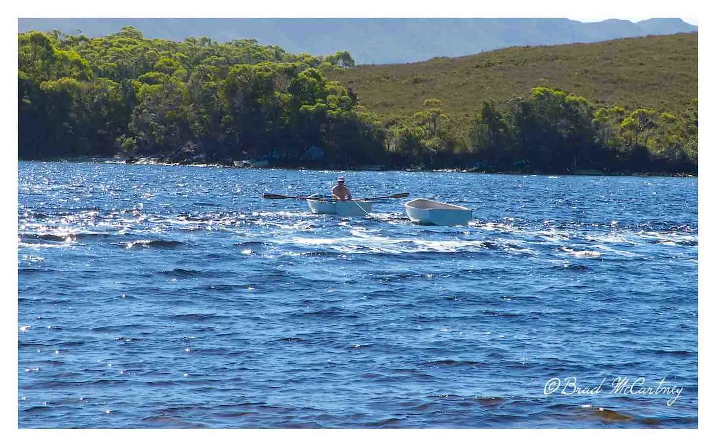
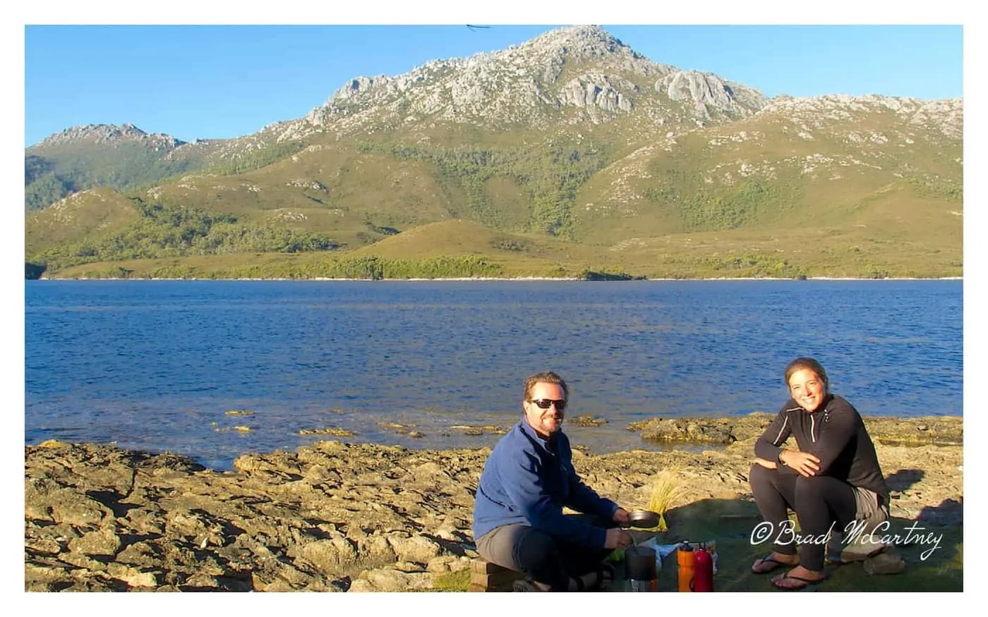
We were there in perfect weather. It was even warm enough for me to go for a swim and I hate cold water. Bathurst Harbour is huge. There is a narrow channel that needs to be crossed by row boat. National Parks provide the boats for hikers. The winds and tidal flow can make things interesting for some groups. We arrived at tides that appeared to be running out through the Bathurst Narrows at about 2 knots. we waited until late afternoon when the tide slowed to cross the 300-meter crossing. There are supplied row boats on either side of the narrow channel which required us to make 3 trips to ensure there was a boat on either side. The campsite on Joan Point was stunning and the afternoon dinner spent watching the setting sun on one of the remotest harbours in Australia was magical.
13km in 8 hours including all rest stops, lunch breaks, photo and/or video stops, swims, boat trips etc

Port Davey Track Day 4
When we set off this morning the weather was grand. Low fog drifted outwards from the harbour onto the surrounding valleys and low-lying country. After another brief geographical error, we arrived near what appeared to be a track which indicated that it went to Mt Beattie. We checked with the map and decided to give it a crack. And I’m so glad we did.
The views from the climb and summit of Mt Beattie were stunning. Bathurst Harbour, Mt Rugby, the narrows and Port Davey were visible as was our ultimate destination for the day, Melaleuca. We lingered at the top for quite a while taking in the vista. We decided to take a shortcut down to the remaining sections of the Port Davey track. It was shorter both in time and distance.
It was a very hot day and we ran out of water while at the top of Mt Beattie. Luckily the short cut took us to a small creek to quench the thirst. We sighted Sven again who was busy making a cup of coffee for the afternoon. He invited us to partake in the ritual. It provided the energy to make it to our destination.
Melaleuca
Melaleuca, our campsite for the night has a free hut to stay in. Valerie, Sven and I were the only ones staying in the hut. There were posters in the hut of Lake Pedder before the dam was built. The old map showed the original Port Davey Track which crossed the now flooded dam area en route to the small town of Maydeena. Must have been quite a trek back in the 60s and earlier. Friendly and helpful volunteer rangers greeted us at the hut. Our food package had arrived so we opened the box of wine and fruitcake after dinner. Only a small amount of wine and I was somewhat tipsy, my tolerance when hiking was non-existent. Suffice it to say I slept well.
17km in 7.5 hours including all rest stops, lunch breaks, photo and/or video stops, etc


The Port Davey Track is often overlooked as one of the boring tracks of the South West. I enjoyed the whole thing from Scotts Peak Dam to Melaleuca. There is diversity and the region around Bathurst Harbour is stunning. The great weather on the trip added to the pleasure. Highly recommended. Click on the link for Part II of the trip to the South Coast Track.
Total of 75km in 4 days including all side trips etc


Have You Hiked the Port Davey Track or though of combining this hike with the South Coast Track? Got a question about hiking? Leave me a message in the comments section below.
Next : Hiking the South Coast Track
More great stuff about hiking in Tasmania:
Best Places to Buy Outdoor Gear in Australia:
Snowys.com.au | Macpac | WildEarth


BikeHikeSafari Gear Review Process
The author, Brad McCartney from BikeHikeSafari is a small independent adventurer and outdoor gear tester who owns and runs BikeHikeSafari.com.
BikeHikeSafari is not part of a large blog network and is proudly independent. All reviews on this site are independent and honest gear reviews of outdoor products by the author.
The author, Brad McCartney is a very experienced triple crown thru-hiker, adventurer, and bike tourer having spent 1000s of nights sleeping in a tent and sleeping bag (Read more). He was a manager of an outdoor retail store and is very experienced in what is important when using and testing gear for reviews like this.
BikeHikeSafari will never receive any money for reviews and they do not accept sponsored reviews on this website. All the comments about the gear reviews are from the author based on his years of experience. Hope this independent review was helpful for you.
Great Trip. Thanks for the great photos.
I am thinking about doing Port Davey by myself before meeting my brother in Melaleuca and continuing onto the Southwest Track. As a solo male, with moderate strength, do you think the boats are too heavy for one person to move about. I won’t have any issues with rowing as I am reasonably fit.
Thanks
Bruce
One person on the boats is fine for most people to move and row. When it is very windy the rowing part can be a bit tricky.
Appreciated for update coz we are doing the Port Davey plus south coast in coming may. But we are still looking for ways to get to Scotty peak dam. Anyway great tips from you guys =)
Hi Felix, good luck in your hike. There are a couple of transport option (look them up on google). Would love to hear which one you took and how it went. Let me know. I got lucky with a lift ????
Hi, that looked like a great trip. I am planning something similar. One thing I can’t work out is whether there a track to the summit of Mt Rugby from the Port Davey Track or is it a bushbash? I am aware of a track on the southern side which I believe is only accessible by boat.
No track to Mt Rugby that I could find, it looks like a bush bash. There is a nice viewpoint from the hill on the other side of the harbour after you row across the channel. Good luck with the hike.
As I recall from 30 years ago it is a bush bash, although fairly easy; and the climb is not really difficult .However it s quite scary because the rocks are just piled together with lots of gaps between and hollows under; very little soil fill in! We went up on the north side and down on the south; to and from the Port Davey track. As long as you watch your step, it is no trouble.
Happy hiking!
Keith
More fun back in those days. I remember my first time on many of the trails in Tassie 25 years ago. Not much boardwalks and lots of knee deep mud.
Great blog Brad, love the pics!
Thanks Marcus, even the pics don’t really do justice to the place, great place for a hike.
Amazing photos! I’m really looking forward to doing this walk when I get a chance!
I’m sure when you get the chance you won’t be disappointed.